


Collins World Atlas: Paperback Edition
$10.99
$13.99


The Korean Cookbook
$39.99
$54.95

Daily Destinations 2026 5.4 X 6.2 Box Calendar
$12.99
$17.99

The Turtle, The Mitten, and An Epic History of Michigan
$11.99
$15.99

DK Top 10 Boston
$11.99
$15.99

This Is Munich: A Children's Classic
$12.99
$17.95
Birds of the Midwest
$5.99
$8.95


Azores: An Extensive Handbook for Vacationers
$11.99
$12.99

The Unofficial Guide to Universal Orlando 2025
$15.99
$21.99


Insight Guides Costa Rica (Travel Guide with Free Ebook)
$18.99
$25.99


Birds of New Mexico Field Guide
$12.99
$16.95


Rooms of Their Own: Where Great Writers Write
$18.99
$26.00


Death in Yellowstone REV Ed PB
$13.99
$18.95
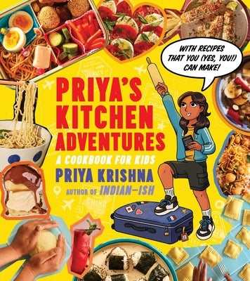
Priya's Kitchen Adventures: A Cookbook for Kids
$21.99
$29.99


Azores Travel Guide 2024
$12.99
$14.99


Vintage Lined Notebook Greetings from Arizona
$9.99
$12.95

RV Camping for Beginners: The Ultimate Road Trip Guide
$21.99
$22.99


Hawai'i Visions
$59.95


