Surprise Castle
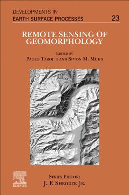
Remote Sensing of Geomorphology: Volume 23

Remote Sensing of Geomorphology: Volume 23 - Paperback

$192.99
Quantity
01

Pay over time for orders over $35.00 with

Offers & Perks

Earn 192 points with this purchase

Added to your rewards balance after checkout.

100 points welcome bonus

Create an account and start with extra points.

Join now
Availability:In StockContributor:Paolo Tarolli, Simon M. MuddSeries:Developments in Earth Surface ProcessesPublish date:4/20/2020Pages:398
Languages:EnglishPublisher:ElsevierISBN-13:9780444641779ISBN-10:0444641777UPC:9780444641779Book Category:Science, Technology & EngineeringBook Subcategory:Earth Sciences, Remote Sensing & Geographic Information SystemsBook Topic:GeologySize:9.25 x 7.50 x 0.82 inchesWeight:0.681Product ID:SC7Q3Y64JK

Remote Sensing of Geomorphology, Volume 23, discusses the new range of remote-sensing techniques (lidar, structure from motion photogrammetry, advanced satellite platforms) that has led to a dramatic increase in terrain information, and as such provided new opportunities for a better understanding of surface morphology and related Earth surface processes. As several papers have been published (including paper reviews and special issues) on this topic, this book summarizes the major advances in remote sensing techniques for the analysis of Earth surface morphology and processes, also highlighting future challenges. Useful for MSc and PhD students, this book is also ideal for any scientists that want to have a single volume guideline to help them develop new ideas. In addition, technicians and private and public sectors working on remote sensing will find the information useful to their initiatives.

Languages:EnglishPublisher:ElsevierISBN-13:9780444641779ISBN-10:0444641777UPC:9780444641779Book Category:Science, Technology & EngineeringBook Subcategory:Earth Sciences, Remote Sensing & Geographic Information SystemsBook Topic:GeologySize:9.25 x 7.50 x 0.82 inchesWeight:0.681Product ID:SC7Q3Y64JK
Paolo Tarolli is Professor in Water Resources Management and Integrated Watershed Management, and PI of Earth Surface Processes and Society research group at the University of Padova (Italy). He has a PhD in Environmental Watershed Management and Geomatics and has worked as academic staff at the University of Padova since 2011. He is an expert in digital terrain analysis, earth surface processes analysis, natural hazards, geomorphology, hydro-geomorphology, LIDAR, and structure-from-motion photogrammetry. His new research directions include the analysis of topographic signatures of human activities from the local to regional scale. He is Deputy President of the Natural Hazards Division of the European Geosciences Union (EGU) and Deputy President of sub-division VII (Information and Communication Technologies) of the Italian Society of Agricultural Engineering. Prof. Tarolli is also Executive Editor of Natural Hazards and Earth System Sciences (Copernicus) and associate editor or editorial board member of several international journals. He is the author of more than 100 papers published in international peer-reviewed journals. He has given more than 20 invited talks in international research institutions and foreign Academies (i.e., Princeton University, EPFL, AgroParisTech, National Cheng Kung University, China University of Geosciences, Dalian University and Technology) and at international meetings (IGC, AAG, ISPRS, RGS-IBG, AOGS-AGU, Soil Science Society of China).
Publisher: Elsevier

Free shipping on orders over $75. Standard shipping takes 3-7 business days. Eligible items may be returned within 30 days of delivery. Conditions apply.