
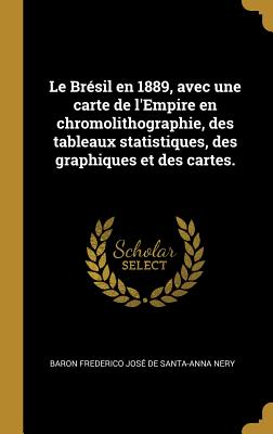
Le Brésil en 1889, avec une carte de l'Empire en chromolithographie, des tableaux statistiques, des graphiques et des cartes. - Hardcover
$41.99
$44.95
-7%Choose Option
Hardcover
$41.99
$44.95

Paperback
$30.99
$32.95
Quantity
01
Pay over time for orders over $35.00 with
Offers & Perks
Earn 41 points with this purchase
Added to your rewards balance after checkout.
100 points welcome bonus
Create an account and start with extra points.
Availability:In StockPublish date:2/8/2019Pages:742
Languages:FrenchPublisher:Wentworth PressISBN-13:9780353665101ISBN-10:035366510XUPC:9780353665101Book Category:ScienceBook Subcategory:Earth SciencesBook Topic:GeographySize:9.21 x 6.14 x 1.56 inchesWeight:1.208Product ID:SCR3G9H6PM
Title: Le Brésil en 1889, avec une carte de l'Empire en chromolithographie, des tableaux statistiques, des graphiques et des cartes. Ouvrage publié par les soins du Syndicat du Comité franco-brésilien pour l'Exposition universelle de Paris ... sous la direction de M. F.-J. de Santa-Anna Nery.
Publisher: British Library, Historical Print Editions
The British Library is the national library of the United Kingdom. It is one of the world's largest research libraries holding over 150 million items in all known languages and formats: books, journals, newspapers, sound recordings, patents, maps, stamps, prints and much more. Its collections include around 14 million books, along with substantial additional collections of manuscripts and historical items dating back as far as 300 BC.
The GEOGRAPHY & TOPOGRAPHY collection includes books from the British Library digitised by Microsoft. Offering some insights into the study and mapping of the natural world, this collection includes texts on Babylon, the geographies of China, and the medieval Islamic world. Also included are regional geographies and volumes on environmental determinism, topographical analyses of England, China, ancient Jerusalem, and significant tracts of North America.
++++
The below data was compiled from various identification fields in the bibliographic record of this title. This data is provided as an additional tool in helping to insure edition identification:
++++
British Library
Santa-anna nery, Baron Frederico José de;
1889.
xix. 699 p.; 8 .
10481.ee.38.
Publisher: British Library, Historical Print Editions
The British Library is the national library of the United Kingdom. It is one of the world's largest research libraries holding over 150 million items in all known languages and formats: books, journals, newspapers, sound recordings, patents, maps, stamps, prints and much more. Its collections include around 14 million books, along with substantial additional collections of manuscripts and historical items dating back as far as 300 BC.
The GEOGRAPHY & TOPOGRAPHY collection includes books from the British Library digitised by Microsoft. Offering some insights into the study and mapping of the natural world, this collection includes texts on Babylon, the geographies of China, and the medieval Islamic world. Also included are regional geographies and volumes on environmental determinism, topographical analyses of England, China, ancient Jerusalem, and significant tracts of North America.
++++
The below data was compiled from various identification fields in the bibliographic record of this title. This data is provided as an additional tool in helping to insure edition identification:
++++
British Library
Santa-anna nery, Baron Frederico José de;
1889.
xix. 699 p.; 8 .
10481.ee.38.
Languages:FrenchPublisher:Wentworth PressISBN-13:9780353665101ISBN-10:035366510XUPC:9780353665101Book Category:ScienceBook Subcategory:Earth SciencesBook Topic:GeographySize:9.21 x 6.14 x 1.56 inchesWeight:1.208Product ID:SCR3G9H6PM
Free shipping on orders over $75. Standard shipping takes 3-7 business days. Returns accepted within 30 days of purchase.