
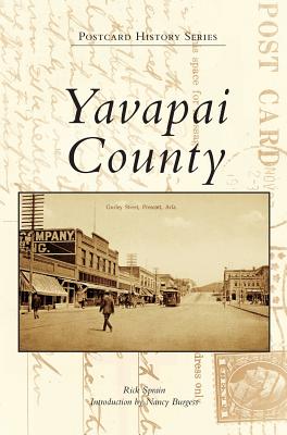
Yavapai County - Hardcover
by Rick Sprain
$23.99
$31.99
-25%Quantity
01
Pay over time for orders over $35.00 with
Offers & Perks
Earn 23 points with this purchase
Added to your rewards balance after checkout.
100 points welcome bonus
Create an account and start with extra points.
Availability:In StockContributor:Rick Sprain, Nancy BurgessTheme:Cultural Region/Southwest U.S.Publish date:12/12/2016Pages:130
Languages:EnglishPublisher:Arcadia Publishing Library EditionsISBN-13:9781540201713ISBN-10:1540201716UPC:9781540201713Book Category:History, Photography, TravelBook Subcategory:United States, Subjects & Themes, PictorialsBook Topic:State & Local, RegionalSize:9.61 x 6.69 x 0.38 inchesWeight:0.413Product ID:SC9AXC3F9K
In 1864, Arizona was divided into four counties named after the local Indian communities: Yavapai, Yuma, Mohave, and Pima. Believed to have been the largest county ever created in the lower 48 states at the time, Yavapai encompassed over 65,000 square miles until 1891, when the state was divided into additional counties. Yavapai finally settled to 8,125 square miles. While still a US territory in 1900, Yavapai County had a population just under 13,800 people and was quite remote. Within a few years, postcards started appearing in drugstores, such as Brisley, Timerhoff, Owl, Heit, Corbin and Bork, or Eagle Drug in Prescott and Lynn Boyd or Mitchell in Jerome. Many of the original postcards showcase early mines, towns, and buildings that no longer exist today.
Languages:EnglishPublisher:Arcadia Publishing Library EditionsISBN-13:9781540201713ISBN-10:1540201716UPC:9781540201713Book Category:History, Photography, TravelBook Subcategory:United States, Subjects & Themes, PictorialsBook Topic:State & Local, RegionalSize:9.61 x 6.69 x 0.38 inchesWeight:0.413Product ID:SC9AXC3F9K
Publisher: Arcadia Publishing Library Editions
Contributor(s)
Author
Free shipping on orders over $75. Standard shipping takes 3-7 business days. Returns accepted within 30 days of purchase.