
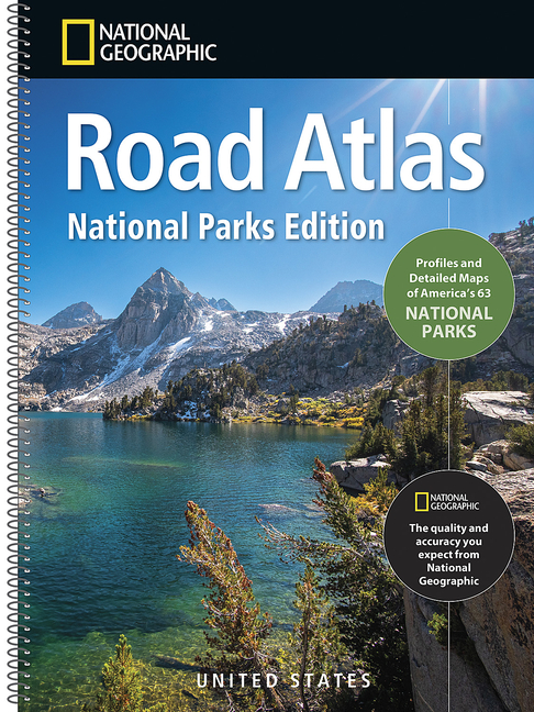
National Geographic Road Atlas 2027: National Parks Edition - Paperback
Pay over time for orders over $35.00 with
Offers & Perks
Earn 25 points with this purchase
Added to your rewards balance after checkout.
100 points welcome bonus
Create an account and start with extra points.
National Geographic brings its trusted cartography to America's national parks. This full-size, spiral-bound atlas spans 277 pages, with 130 pages dedicated to detailed guides for all 63 national parks -- plus a checklist, distance maps, QR codes, and a road trip planner to connect them into one epic loop. Here's what's inside:
- Trusted National Geographic Accuracy -- Detailed, easy-to-read maps updated annually, with a clear visual hierarchy that puts major landmarks front and center and fades smaller details into the background so you're never squinting at clutter.
- Two Full Pages for Every National Park -- 130 pages give each of the 63 national parks its own two full pages, pairing detailed maps with vivid photography that showcases the park's most breathtaking scenery.
- A Checklist for Every Park -- Track your progress with a built-in checklist for marking off each of the 63 parks as you visit.
- Distance Maps Between Parks -- See exactly how far it is from one national park to the next, so you can plan the smartest route between stops.
- One Road Trip, all 63 Parks -- A road trip route that connects every national park into a single cross-country loop.
- QR Codes for Every Park -- Scan the code on each park's pages for more information beyond what's printed, from trip-planning tips to what to see once you arrive.
- Direct Link to the National Park Service -- A dedicated QR code takes you straight to the official National Park Service website for current alerts, permits, and park info.
- Built for the Long Haul -- A full-size, 277-page, spiral-bound atlas made to handle the whole trip.
This atlas's cartography is built to show the full range of what's out there: major landmarks are surfaced first on the page, while smaller points of interest fade to the background so the map stays easy to read instead of cluttered. That same range carries through the content -- a built-in checklist and distance maps sit alongside a single road trip route that ties all 63 parks together into one continuous loop, whether you're chasing the biggest icons or the quietest, least-visited corners of the system.
Visitor maps and descriptions for each park guide you to the destination that's right for you, backed by National Geographic and the National Park Service's nearly century-long partnership focused on preserving, documenting, and promoting North America's protected natural and historical treasures. Beyond the printed page, a QR code on each park's pages links to more information than paper alone can hold, and a separate QR code connects you straight to the official National Park Service website for current alerts, permits, and park details, so trip planning stays current long after the atlas leaves the shelf.
Plan every stop with confidence using a detailed, easy-to-follow atlas that shows the full journey at a glance -- beyond what a small screen can offer. Clear, full-color, up-to-date maps make it simple to navigate, discover routes, and spot worthwhile stops along the way. At 277 pages, spiral-bound and full-size, it's built to stay open and easy to use in the car from departure to destination, turning 63 separate visits into one connected, unforgettable adventure that's as rewarding to plan as it is to drive.
- Folded Size = 11" x 15"
Edition
2027 Edition
Contributor(s)
Author
Free shipping on orders over $75. Standard shipping takes 3-7 business days. Eligible items may be returned within 30 days of delivery. Conditions apply.