
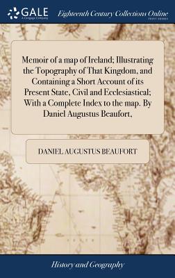
Memoir of a map of Ireland; Illustrating the Topography of That Kingdom, and Containing a Short Account of its Present State, Civil and Ecclesiastical - Hardcover
$31.99
$33.95
-6%Quantity
01
Pay over time for orders over $35.00 with
Offers & Perks
Earn 31 points with this purchase
Added to your rewards balance after checkout.
100 points welcome bonus
Create an account and start with extra points.
Availability:In StockContributor:Daniel Augustus BeaufortTheme:Chronological Period/18th CenturyPublish date:4/19/2018Pages:252
The 18th century was a wealth of knowledge, exploration and rapidly growing technology and expanding record-keeping made possible by advances in the printing press. In its determination to preserve the century of revolution, Gale initiated a revolution of its own: digitization of epic proportions to preserve these invaluable works in the largest archive of its kind. Now for the first time these high-quality digital copies of original 18th century manuscripts are available in print, making them highly accessible to libraries, undergraduate students, and independent scholars.
Rich in titles on English life and social history, this collection spans the world as it was known to eighteenth-century historians and explorers. Titles include a wealth of travel accounts and diaries, histories of nations from throughout the world, and maps and charts of a world that was still being discovered. Students of the War of American Independence will find fascinating accounts from the British side of conflict.
++++
The below data was compiled from various identification fields in the bibliographic record of this title. This data is provided as an additional tool in helping to insure edition identification:
++++
British Library
T144852
With a list of 'Patronisers and subscribers to the map'. P. 147 bears the imprint: "printed by T. Rickaby. 1792." - The index has separate pagination and register. With a final errata leaf.
London: sold by W. Faden, Geographer to the King; J. Debrett, and James Edwards, 1792. [14], xvii, [1],147, [1],71, [3]p., plate: map; 4
Rich in titles on English life and social history, this collection spans the world as it was known to eighteenth-century historians and explorers. Titles include a wealth of travel accounts and diaries, histories of nations from throughout the world, and maps and charts of a world that was still being discovered. Students of the War of American Independence will find fascinating accounts from the British side of conflict.
++++
The below data was compiled from various identification fields in the bibliographic record of this title. This data is provided as an additional tool in helping to insure edition identification:
++++
British Library
T144852
With a list of 'Patronisers and subscribers to the map'. P. 147 bears the imprint: "printed by T. Rickaby. 1792." - The index has separate pagination and register. With a final errata leaf.
London: sold by W. Faden, Geographer to the King; J. Debrett, and James Edwards, 1792. [14], xvii, [1],147, [1],71, [3]p., plate: map; 4
Publisher: Gale Ecco, Print Editions
Contributor(s)
Author
Free shipping on orders over $75. Standard shipping takes 3-7 business days. Eligible items may be returned within 30 days of delivery. Conditions apply.