
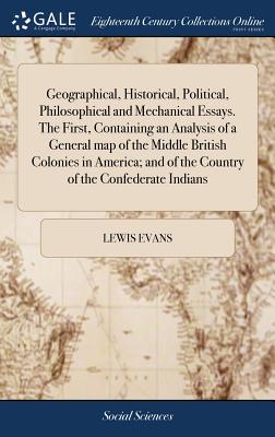
Geographical, Historical, Political, Philosophical and Mechanical Essays. The First, Containing an Analysis of a General map of the Middle British Col - Hardcover
by Lewis Evans
$24.99
$26.95
-7%Quantity
01
Pay over time for orders over $35.00 with
Offers & Perks
Earn 24 points with this purchase
Added to your rewards balance after checkout.
100 points welcome bonus
Create an account and start with extra points.
Availability:In StockContributor:Lewis EvansTheme:Chronological Period/18th CenturyPublish date:4/25/2018Pages:44
Languages:EnglishPublisher:Gale Ecco, Print EditionsISBN-13:9781385812341ISBN-10:1385812346UPC:9781385812341Book Category:Social Science, History, ScienceBook Subcategory:Modern, Earth SciencesBook Topic:18th Century, GeographySize:9.21 x 6.14 x 0.25 inchesWeight:0.245Product ID:SCVFXS6S2J
The 18th century was a wealth of knowledge, exploration and rapidly growing technology and expanding record-keeping made possible by advances in the printing press. In its determination to preserve the century of revolution, Gale initiated a revolution of its own: digitization of epic proportions to preserve these invaluable works in the largest archive of its kind. Now for the first time these high-quality digital copies of original 18th century manuscripts are available in print, making them highly accessible to libraries, undergraduate students, and independent scholars.
Delve into what it was like to live during the eighteenth century by reading the first-hand accounts of everyday people, including city dwellers and farmers, businessmen and bankers, artisans and merchants, artists and their patrons, politicians and their constituents. Original texts make the American, French, and Industrial revolutions vividly contemporary.
++++
The below data was compiled from various identification fields in the bibliographic record of this title. This data is provided as an additional tool in helping to insure edition identification:
++++
Library of Congress
W014361
Map drawn by Evans; engraved by James Turner. Cf. Stevens, H.N. Lewis Evans, his map of the middle British colonies in America, 2nd ed., London, 1920.
Philadelphia: Printed by B. Franklin, and D. Hall, MDCCLV. [1755]. iv,32p., [1]folded leaf of plates: 1 map; 4
Delve into what it was like to live during the eighteenth century by reading the first-hand accounts of everyday people, including city dwellers and farmers, businessmen and bankers, artisans and merchants, artists and their patrons, politicians and their constituents. Original texts make the American, French, and Industrial revolutions vividly contemporary.
++++
The below data was compiled from various identification fields in the bibliographic record of this title. This data is provided as an additional tool in helping to insure edition identification:
++++
Library of Congress
W014361
Map drawn by Evans; engraved by James Turner. Cf. Stevens, H.N. Lewis Evans, his map of the middle British colonies in America, 2nd ed., London, 1920.
Philadelphia: Printed by B. Franklin, and D. Hall, MDCCLV. [1755]. iv,32p., [1]folded leaf of plates: 1 map; 4
Languages:EnglishPublisher:Gale Ecco, Print EditionsISBN-13:9781385812341ISBN-10:1385812346UPC:9781385812341Book Category:Social Science, History, ScienceBook Subcategory:Modern, Earth SciencesBook Topic:18th Century, GeographySize:9.21 x 6.14 x 0.25 inchesWeight:0.245Product ID:SCVFXS6S2J
Free shipping on orders over $75. Standard shipping takes 3-7 business days. Eligible items may be returned within 30 days of delivery. Conditions apply.